
Thermal Drone
Thermal drones can help locate suspected anomalous modules. See what a thermal drone captures on a PV array, how accurate the data is and where its limits lie.
What a Thermal Drone Is
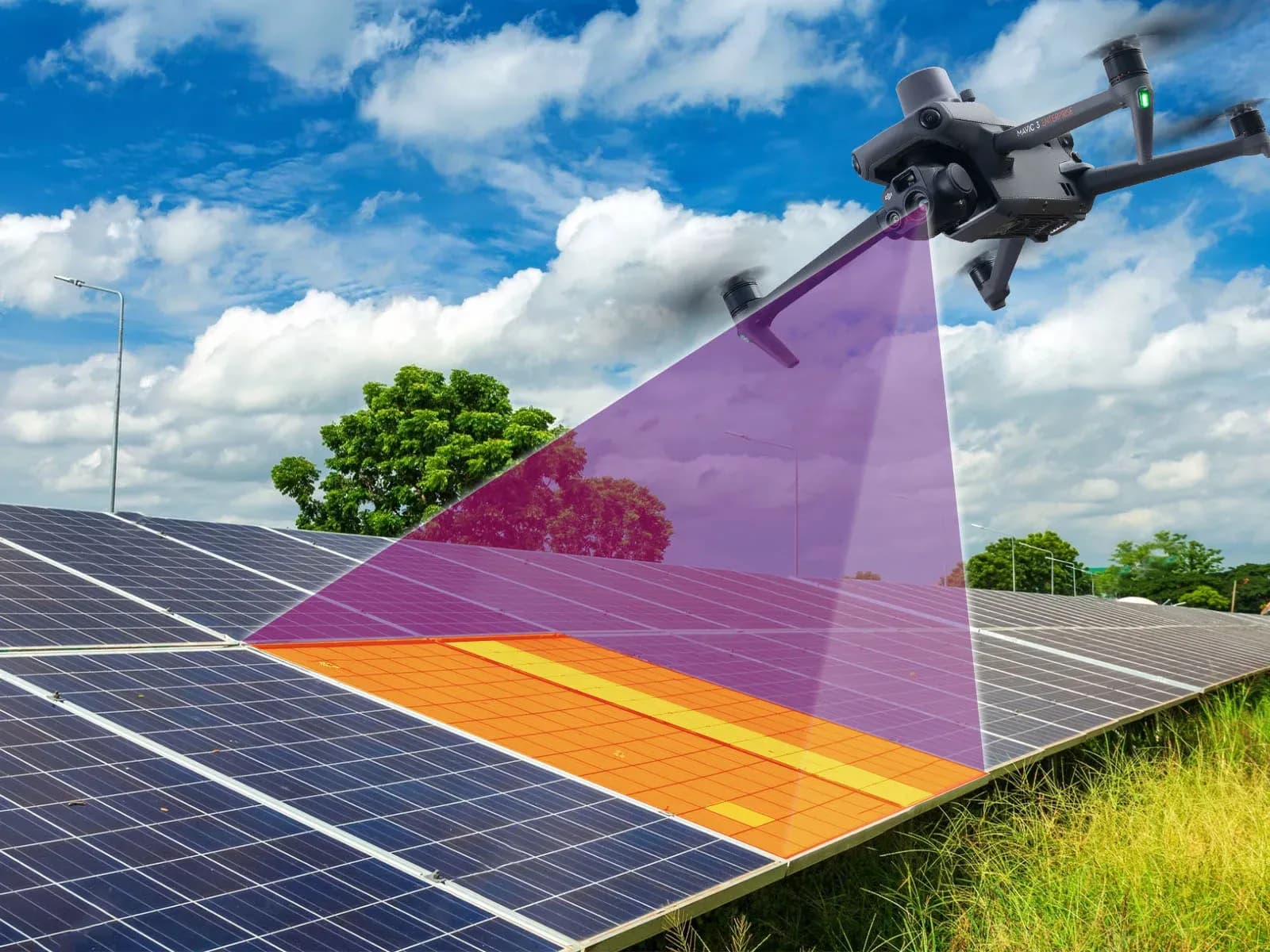
A thermal drone is an unmanned aircraft carrying an infrared camera that records temperature-related information from surfaces below or around the aircraft. In PV inspection, it is used to observe thermal patterns across operating modules, strings, connectors, and selected electrical equipment without beginning with a ground-level inspection of every component.
Not every thermal camera provides the same type of temperature measurement. Some cameras primarily produce thermal imagery, while others provide calibrated temperature information for image pixels or measurement areas. The measurement capability depends on the camera design, calibration, settings, and operating conditions.
The aircraft and camera should therefore be considered separately. Flight stability, positioning, altitude control, and route repeatability depend on the drone platform, while thermal resolution, lens characteristics, temperature measurement capability, and sensitivity depend on the camera.
A thermal drone does not directly measure electrical current, voltage, insulation resistance, or continuity. It records surface thermal behavior that can point inspectors toward areas requiring further investigation.
How Thermal Imaging Works on a PV Array
PV modules absorb solar energy and operate electrically while exposed to sunlight. Their surface temperature is influenced by irradiance, electrical loading, module construction, ambient conditions, wind, mounting arrangement, shading, and other factors. When one cell, module area, connector, or circuit behaves differently, it may produce a thermal pattern that differs from comparable equipment.
The thermal camera records infrared radiation from the viewed surfaces and converts it into image information. Inspectors then compare patterns between modules or components that are operating under similar conditions. Relative differences can be useful even when the absolute temperature alone does not explain the condition.
A localized warm cell may deserve investigation, while a broader module pattern can be associated with bypass behavior, shading, circuit state, or another cause. Connector or terminal heating may also appear when increased electrical resistance produces heat under load.
The image still requires interpretation. Reflections, viewing angle, wind, cloud movement, and changing irradiance can create or suppress apparent temperature differences. A thermal pattern should therefore be treated as an observation before it is treated as a diagnosis.
IEC 62446-3 provides a framework for outdoor thermographic inspection of operating PV systems, including equipment, environmental conditions, procedure, personnel competence, and reporting.
Advantages for Solar Inspection
A thermal drone can screen large areas of a PV plant without requiring inspectors to approach every module during the initial survey. On large ground-mounted sites, this can reduce unnecessary walking and help identify the rows or modules that deserve closer examination.
The method can also preserve location context. When thermal imagery is linked to flight position, plant layout, row identifiers, or visible images, a maintenance team can return to the affected area more directly. That is more useful than a thermogram whose physical location is uncertain.
Aerial acquisition can provide a consistent overview of repeated module geometry when the route and viewing conditions are controlled. This is useful for comparing similar equipment across a plant, especially when the survey objective and target resolution are defined before flight.
The operational benefit depends on the site. Difficult airspace, small inspection areas, irregular module layouts, high wind, poor thermal conditions, or extensive ground verification can reduce the practical advantage of using a drone.
A thermal drone may therefore reduce field effort in some inspections, but it should not be described as automatically cheaper, faster, or more effective for every plant. The value depends on plant size, access, required detail, conditions, and the type of finding being investigated.
Photos, Video and Datasets: What to Capture
A useful inspection dataset should preserve more than isolated thermal screenshots. Thermal still images provide detailed evidence for individual findings, while corresponding visible photographs can help identify physical damage, contamination, shading, module position, or other context.
Video may provide broader situational context, but it should not automatically replace still imagery where measurement detail or traceability is required. Compression, movement, changing angle, and lower per-frame detail can make some video data less suitable for precise thermal review.
Flight metadata also matters. Date, time, location, altitude, camera geometry, and route information can help connect an observation to the correct physical equipment. Environmental data such as irradiance, wind, cloud conditions, and module temperature are particularly relevant when thermal findings will be compared across the plant or between surveys.
The dataset should identify areas that were not captured reliably. Obstructions, poor focus, reflections, communication interruptions, or unsafe flight zones can leave gaps that need to be documented rather than silently treated as inspected.
Image quantity should remain tied to review value. Capturing more data can increase the chance of documenting a finding, but it also increases storage and review workload. The inspection workflow should preserve enough information to support decisions without creating an unmanaged archive.
How Accurate Thermal Data Is
Thermal accuracy depends on several separate characteristics. Spatial resolution determines how much physical detail is represented in the image, while thermal sensitivity describes how small a temperature difference the camera can distinguish under specified conditions. NETD is commonly used to describe thermal sensitivity and should not be treated as the same thing as measurement accuracy.
Temperature measurement accuracy is another characteristic. It relates to how closely reported temperature corresponds to the actual target temperature under the camera's specified measurement conditions. A camera can have good sensitivity while still being affected by emissivity settings, reflections, distance, atmosphere, calibration, and viewing geometry.
For PV inspection, resolution matters because a cell-level feature must occupy enough image area to be interpreted. A camera cannot reliably identify a small thermal pattern if the flight height or lens causes the target to be represented by too few pixels.
Environmental conditions can create larger uncertainties than the camera specification alone suggests. Wind cools module surfaces, cloud movement changes electrical loading, and reflections from glass can produce apparent temperature patterns unrelated to internal module behavior.
Accuracy should therefore be evaluated as a measurement system that includes the camera, flight geometry, target, settings, environment, and inspection procedure. A single specification in a datasheet does not describe the reliability of every field measurement.
How Long a Survey Takes
There is no fixed duration for a thermal drone survey. The time required depends on site area, row geometry, module orientation, terrain, flight restrictions, camera resolution, target detail, weather, battery operation, and the amount of data that must be captured.
A survey intended to identify broad module-level patterns can use a different flight profile from one intended to resolve cell-level features. Lower flights and denser image capture can increase the number of flight lines and images, while higher flights may reduce detail below the required inspection resolution.
Site access can also affect total field time. Long travel distances between launch points, restricted zones, difficult terrain, coordination with plant personnel, or the need to reposition between array sections can add operational time even when the aircraft itself flies efficiently.
Weather is another major variable. Wind, changing cloud cover, or unsuitable irradiance may require the team to pause, repeat part of the survey, or postpone thermal acquisition. Finishing the route quickly has little value if the resulting data cannot be interpreted reliably.
Review time should also be considered separately from flight time. A large dataset can require substantial organization, quality control, location matching, and analysis after the aircraft has landed.
For these reasons, survey duration should be estimated from the actual site and inspection objective rather than from a universal time-per-megawatt or time-per-acre claim.
Limits
Thermal drone data does not prove root cause. A warm cell, connector, module area, or unusual string pattern can identify a candidate for investigation, but several electrical, environmental, or physical causes may produce similar thermal behavior.
Thermography also does not directly establish insulation resistance, polarity, open-circuit voltage, short-circuit current, continuity, IV characteristics, or complete functional behavior. When those properties matter to the maintenance decision, an appropriate electrical test is required.
A thermal survey should not be described as extending module or plant life by itself. Inspection may help identify conditions that maintenance teams choose to address, but any effect on equipment life depends on the actual defect, corrective action, operating environment, and subsequent condition.
One flight is not continuous monitoring. Intermittent problems may not be active during the survey, and new conditions can develop after the inspection.
IEC 62446-3 does not define a software algorithm or one universal module-temperature threshold. It addresses how outdoor thermographic inspection of operating PV systems is performed and documented under appropriate conditions.
Software can organize imagery, findings, and reports, but it does not replace electrical testing or qualified interpretation.