Drone Solar Panel Inspection
Drone solar panel inspection: how it works, what data it produces, limits, comparison with other methods, and when aerial screening saves time.
How Drone Solar Inspection Works
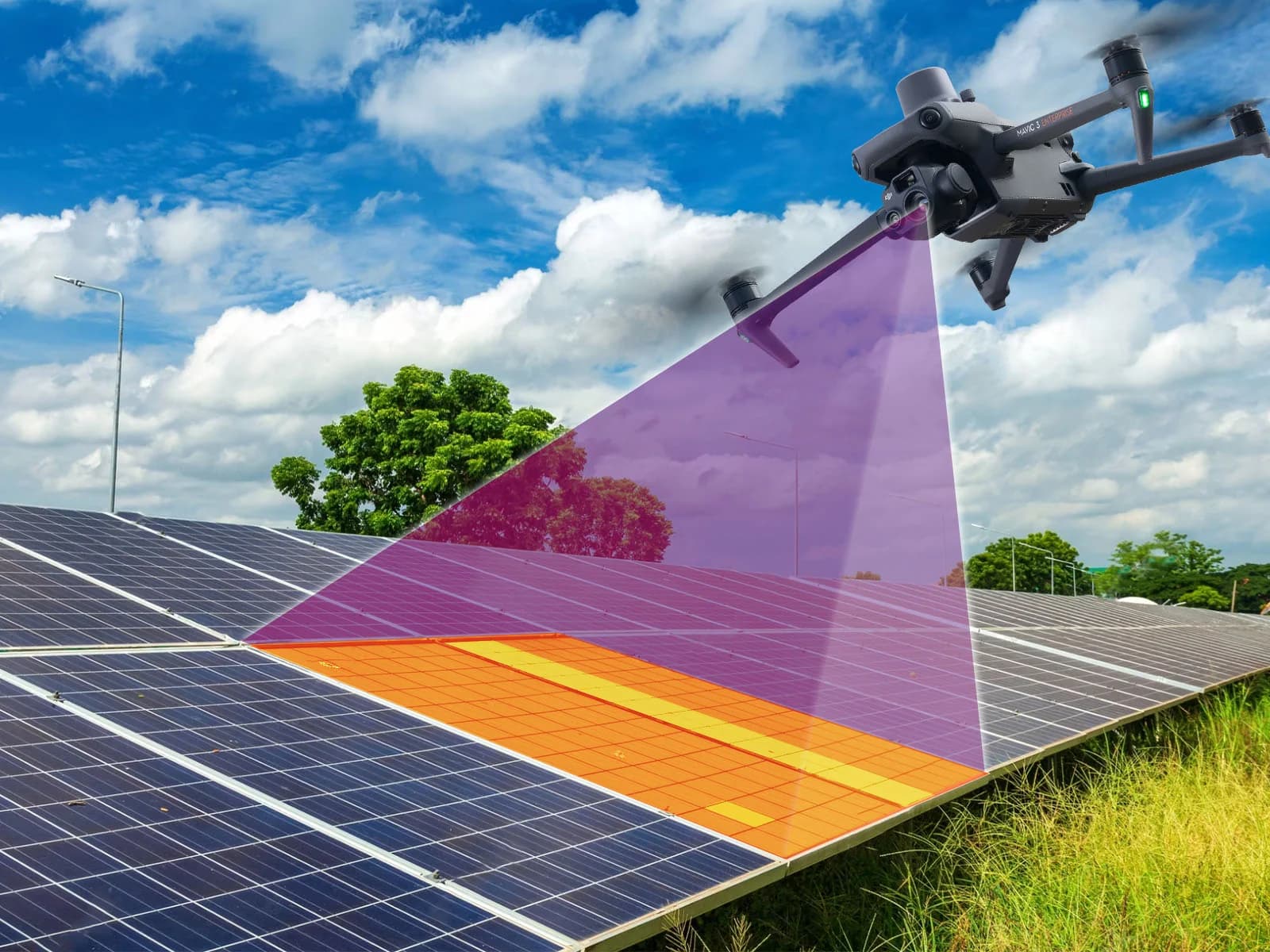
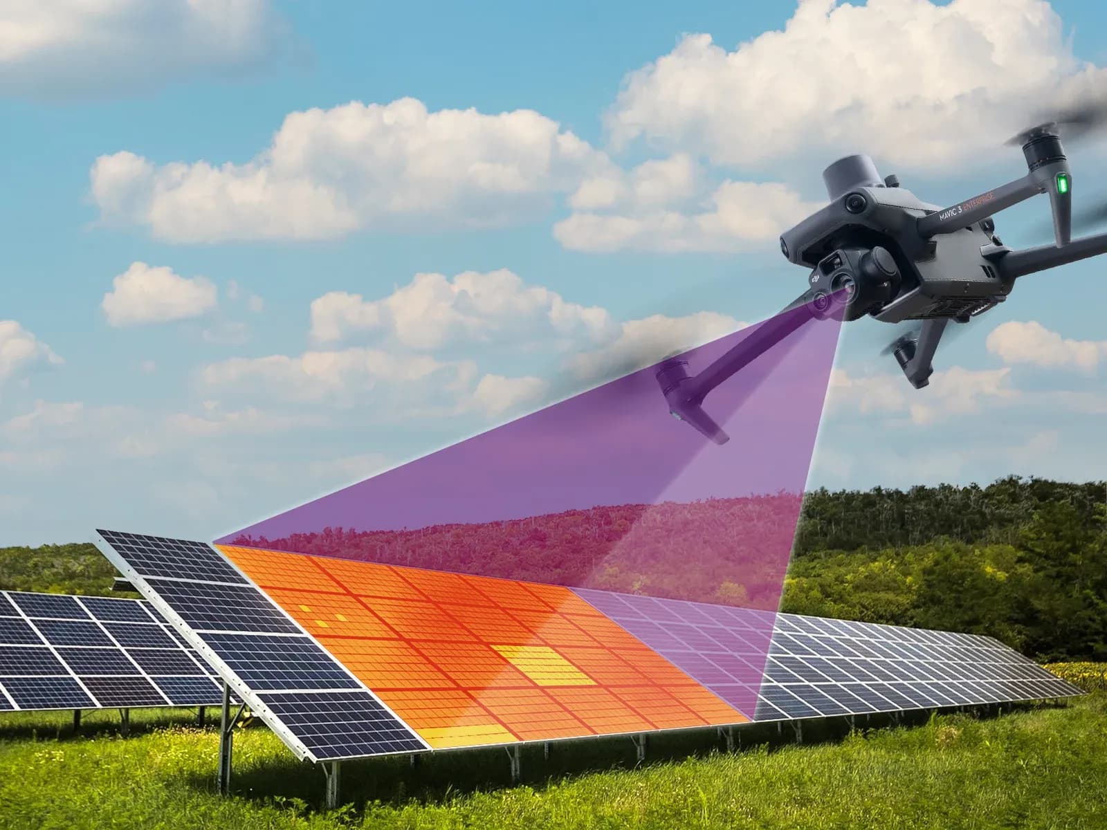
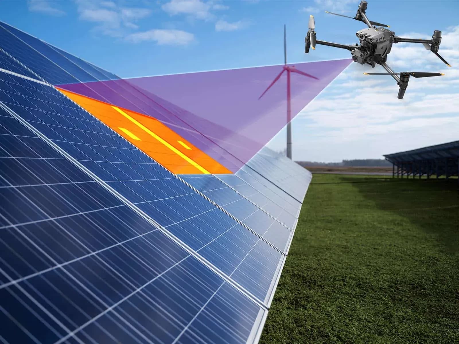
Drone solar panel inspection collects thermal and visual evidence over operating PV arrays to locate candidate anomalies. IEC 62446-3 addresses outdoor PV thermography; the inspection procedure must account for equipment, acquisition conditions, interpretation and reporting rather than rely on a short universal checklist.
- Measure irradiance relevant to the module plane
- Assess wind for flight safety and thermal measurement quality
- Record cloud transitions and illumination changes
- Allow operating and thermal conditions to stabilize after changes
Plan flight height, speed, viewing angle and overlap around the detail needed in the thermal image. Ground sample distance describes pixel footprint, not temperature accuracy or guaranteed cell-level detection. Preserve original imagery and separate environmental logs where the camera does not embed them.
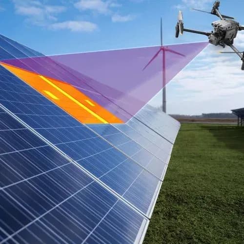
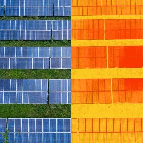
Three parameters do most of the work. Ground sample distance, the ground distance represented by one image pixel, sets how much module detail is resolvable and is driven mainly by altitude. Overlap between frames decides whether the dataset can be assembled into a continuous positioned mosaic. Capture angle decides measurement validity, because looking at a module from a steep oblique angle changes what the thermal camera reads from its glass surface. MapperX documents 3 cm and 5 cm analysis workflows, and the flight parameters each supported drone model needs to reach them are published in the MapperX platform documentation.
After capture, the analysis stage aligns the imagery to the plant layout, segments individual modules, and classifies temperature patterns into fault candidates. Automation matters here mostly because of volume: a large site produces far more frames than a human can review consistently, and consistency across a whole array is what makes one campaign comparable with the next. MapperX uses AI-assisted analysis with human review; results depend on operating conditions, acquisition quality and validation. How the pattern classification itself works is covered in how AI-assisted thermography detects solar panel faults.
Thermal Measurement and Anomaly Detection
Thermal images reveal surface-temperature patterns that may warrant investigation. Classify observations using a documented method, considering pattern, reference temperature, operating conditions and supporting evidence. Do not assign universal safety categories from ΔT alone.
- Localized heating: identify the affected area and reference temperature
- Repeated module or string pattern: check electrical grouping and operating state
- Unclear pattern: document limitations and request further evidence
If temperature differences are normalized, record the method and inputs. Normalization cannot remove every environmental or operating-state difference, and temperature alone does not quantify lost energy.
Aerial thermography detects faults that produce a temperature difference while current is flowing, which is a specific and useful subset rather than everything that can go wrong with a PV plant. The clearest patterns are single cell hotspots, bypass diode activation showing as a heated substring block, whole module or string outages appearing as uniformly warmer or cooler regions, junction box heating, and connection or interconnect heating at module level.
What it detects poorly or not at all is equally important to state. Faults that produce no thermal signature under the operating conditions of the flight will not appear. Problems inside sealed enclosures, insulation degradation, gradual uniform degradation across a whole array, and most protective device issues are outside the method. Cell level microcracks without a thermal signature cannot be identified by aerial thermography, and even when heating is present, thermal anomalies alone do not confirm microcracks.
This is where fleet level failure data is worth consulting rather than a vendor list. IEA PVPS Task 13 has published reviews of how frequently individual failure modes occur across operating photovoltaic fleets, which is a better basis for deciding what a screening method needs to catch than any single project's experience.
MapperX Analysis and Inspection Records
MapperX can organize thermal and visual inspection data into mapped findings and reports. Technical review should confirm acquisition quality, asset identity and the basis of each classification before the results are used for maintenance.
- Reviews available irradiance, wind and calibration records.
- Documents measurement settings and correction assumptions.
- Maps findings with documented review and priority categories.
- Produces standardized PDF and digital reports with GPS-anchored IR-RGB overlays.
Report acceptance depends on the recipient’s requirements and the agreed inspection scope. A software workflow or standards citation does not guarantee acceptance by EPC firms, insurers or regulators.

Drone Solar Inspection in Large-Scale PV Farms
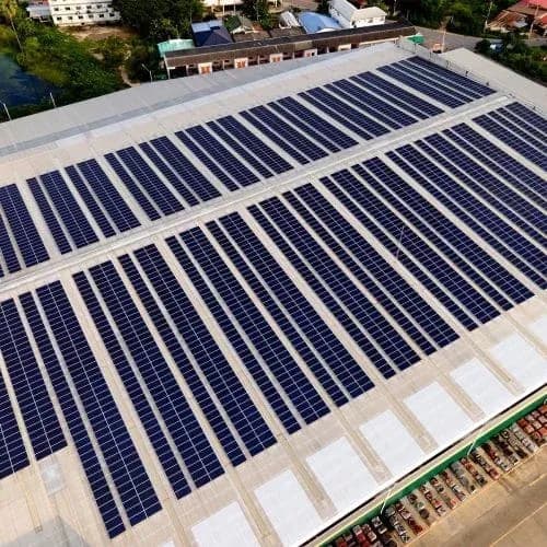
Aerial surveys can screen large arrays while they operate, reducing the need for initial module-by-module access. Actual coverage and turnaround depend on weather, obstacles, required detail and data quality. Identify inaccessible and unusable areas explicitly rather than counting all captured images as completed inspection.
Key advantages include:
- Early fault detection (hot spots, diode failures, string disconnections).
- Supporting evidence for commissioning review.
- Benchmarking across geographically dispersed sites.
Professional Applications and Benefits
Drone Solar Inspection supports multiple segments of the solar industry. It delivers measurable value across operations, maintenance, and investment workflows by turning raw aerial data into actionable insights.
- Utility-scale O&M: faster fault isolation and preventive maintenance.
- Commercial & Industrial (C&I): efficient rooftop analysis.
- Floating PV: contactless screening with site-specific flight-risk assessment.
- Investors: quantitative documentation for risk management.
Drone inspection provides location-aware evidence for solar asset management. Its value depends on verified coverage, credible interpretation and follow-through on findings.
Solar Panel Inspection Process - Step by Step with MapperX
- Fly Your Drone: Plan a compatible thermal/RGB flight and check a sample dataset.
- Make a Fast and Secure Payment: Confirm the selected service and payment conditions.
- Upload Your Photos: Upload the original image files with location and acquisition details.
- Receive Your Report in Just a Few Clicks: Review the mapped findings and report; assign any required field verification.
Generate your reports in supported languages.
The interface and PDF outputs are available in Turkish, English, German, French, Spanish, Chinese, Japanese, Portuguese, Bahasa Indonesia, Italian, and Dutch.
Drone solar panel inspection uses thermal and visual cameras to survey PV arrays from the air, map candidate anomalies and prioritize field verification. It is particularly useful on large plants because a planned flight can collect consistent imagery across far more modules than manual spot checks.
From Drone Images to Maintenance Decisions
The useful output of a drone inspection is not the image count. Thermal and visual evidence should be associated with the correct PV asset, reviewed for acquisition quality and converted into findings that a field team can verify. A mapped workflow makes reinspection and repair tracking much easier than a folder of unstructured images.
What to Prepare Before the Drone Team Arrives
Provide an up-to-date array layout, module and inverter identifiers, known outages, access constraints and the inspection objective. A commissioning baseline, a storm assessment and a troubleshooting survey may need different coverage and follow-up. Confirm operating status with the plant team: an intentionally disconnected string should not be reported as an unexplained failure.
- Define the target detail: whole-module screening or closer investigation of smaller features.
- Agree safe takeoff areas, site permissions, airspace responsibilities and a weather contingency.
- Request a coverage record showing excluded rows, reflections, blurred frames and areas requiring another pass.
- Specify how each finding will be located by the technician and how unresolved observations will be handed over.
Review a sample dataset before completing the site, not after the crew leaves. If the thermal detail or mapping is inadequate, adjust the mission while a repeat flight is still practical. Include analysis and field verification in the inspection cost, rather than purchasing flight time alone. A usable survey ends with traceable findings and coverage limitations, not simply a large folder of aerial images.
What Data Does a Drone Inspection Actually Produce?
A drone inspection produces four distinct outputs, and buyers routinely receive only the first one. The thermal layer carries temperature values per pixel, which is what allows a quantitative statement about a pattern. Screen color thermal exports, where the file holds only display colors, cannot support that statement, so the file format matters more than the camera brand.
The visual layer is captured on the same flight and can help explain a temperature pattern by showing cracked glass, a shading object, soiling, or physical damage visible on the module surface. The positioned mosaic is what places every frame in the plant coordinate system so a finding can be given a module reference rather than a file name. The findings layer is the structured output: one entry per candidate fault, with its module position, its classification, its supporting frames and its severity.
Only the fourth layer survives into next year's decision making. A report that shows warm areas on a picture is a snapshot. Findings tied to module identity accumulate into a record that shows whether a fault is new, spreading or already repaired, which is the whole reason for building a digital twin of your solar plant.
How Does Drone Inspection Compare With Other Methods?
Drone inspection compares favorably on coverage and poorly on confirmation, which is the whole reason it belongs in a program rather than replacing one. Against a handheld thermal walk it covers vastly more modules per hour, applies a consistent capture geometry, and produces positioned data instead of a folder of photos, but it cannot inspect the back of a module or open an enclosure. Against string level current voltage curve tracing it is far faster and far less diagnostic: curve tracing explains the electrical behavior of a string, aerial screening only points at where to trace.
The practical pattern in mature operations is sequencing rather than choosing. Screening flies the whole site and produces a ranked candidate list. Field crews then spend their limited hours on the ranked candidates instead of on a uniform walk, and use handheld thermal imaging and electrical testing to confirm. The saving is not in replacing the crew, it is in aiming it.
- Coverage rate: Drone thermal screening (Site-wide coverage across planned flights; flight count depends on site size, layout and flight time); Handheld thermal walk (Limited by walking distance and crew hours); String level curve tracing (One string at a time)
- What it answers: Drone thermal screening (Where are the candidates across the whole array?); Handheld thermal walk (What does this module look like thermally, up close?); String level curve tracing (How is this string behaving electrically?)
- Diagnostic depth: Drone thermal screening (Classification of a pattern); Handheld thermal walk (Closer confirmation of a pattern); String level curve tracing (Direct electrical characterization)
- Plant state required: Drone thermal screening (Generating under stable irradiance); Handheld thermal walk (Generating, close access required); String level curve tracing (String isolated for the measurement)
- Output that persists: Drone thermal screening (Positioned findings tied to module identity); Handheld thermal walk (Photos and notes per inspected module); String level curve tracing (Curves and derived parameters per string)
- Best role in a program: Drone thermal screening (Decide where the crew goes); Handheld thermal walk (Confirm what the screening flagged); String level curve tracing (Explain why a flagged string underperforms)
What Conditions Must Be Met for the Data to Be Valid?
Valid thermal data requires the plant to be generating under stable conditions, and a flight outside that window produces a dataset that looks complete and cannot be trusted. Load dependent faults only reveal themselves while current is flowing, so the array has to be producing meaningfully during capture. Irradiance has to be both sufficient and stable, with 600 W/m² commonly set as the minimum for outdoor thermographic inspection of PV systems, and drifting cloud during a pass makes two halves of the same block disagree.
Wind, ambient temperature and time of day all affect how quickly a warm module sheds heat and therefore how visible a pattern is. Positioning quality decides whether a finding lands on the correct module or on its neighbor. Coverage completeness decides whether a missing string was healthy or simply never flown.
Those four conditions, generation state, irradiance stability, positioning quality and coverage completeness, are what re-flight criteria exist to protect. A provider with written re-flight criteria is telling you the dataset gets checked before it gets analyzed. A campaign with none can still deliver a full looking report from data that never met the conditions for a valid measurement.
What Are the Limits of Drone Solar Panel Inspection?
The hard limit of drone solar panel inspection is that it observes symptoms, not causes. A heated substring block is consistent with a bypass diode conducting, and confirming that requires qualified personnel on site with test equipment. Treating a classified candidate as a confirmed fault is how a maintenance plan ends up replacing healthy hardware.
Operational limits matter as well. Aerial work is subject to national aviation rules, which in the United States means operating under the applicable small unmanned aircraft regulations, with additional coordination near controlled airspace. Sites near airports, in restricted zones, or with security constraints can require lead time measured in weeks. Weather windows narrow the calendar further, and short clear weather seasons create real re-flight risk that a contract should allocate explicitly.
There is also a boundary that no software crosses. Aerial thermography and automated analysis are technical decision support: they locate and classify thermal patterns across an entire plant quickly and document what was captured, and qualified personnel decide what those patterns mean.
When Do Drones Save Time, and When Do They Not?
Drones save time when the array is large, accessible and reasonably uniform, because the fixed cost of mobilizing a flight is spread across many modules and the coverage advantage compounds. Utility scale ground mount sites, large commercial rooftops and multi site portfolios clustered into one visit are the clearest cases.
They save little or nothing on small, heavily obstructed or airspace restricted sites. A residential roof can be inspected with a handheld camera in the time it takes to plan and clear a flight. A site inside controlled airspace can spend more calendar time on permissions than on the inspection itself. Arrays with complex geometry, heavy shading or many small disconnected sections lose the uniform capture geometry that makes aerial analysis efficient.
The decision rule that holds up in practice: use aerial screening when the question is where should the crew go, and use direct methods when the question is what exactly is wrong with this specific string. Programs that run both in that order combine aerial coverage with targeted diagnostic evidence.
How a drone inspection campaign runs
- Clear the airspace: Confirm the applicable aviation rules, airspace class, site permissions and any security constraints before dates are promised. This is the stage that slips.
- Plan the flight: Set altitude, overlap, speed and capture angle from the target analysis level, and match them to what the selected drone and camera can actually deliver.
- Wait for the window: Fly inside a stable irradiance window with the plant generating. A dataset captured outside it looks complete and cannot support a quantitative finding.
- Capture thermal and visual together: Record temperature embedded thermal files and RGB on the same mission, so every pattern has a visual counterpart from the same conditions.
- Align, segment and classify: Position the imagery against the plant layout, segment individual modules, and classify candidate faults with a severity rank.
- Verify in the field: Send crews to the ranked candidates with handheld thermal imaging and electrical test equipment. This stage is what turns candidates into confirmed faults.
Key facts
- Method type: Screening and localization, not electrical confirmation
- Flight parameters that decide validity: Ground sample distance, frame overlap, capture angle
- Analysis levels documented: 3 cm and 5 cm GSD workflows
- Required plant state: Generating under load, no shutdown and no physical contact with modules
- Irradiance condition: Stable window, commonly set at 600 W/m² or above for outdoor PV thermography
- Data prerequisite: Temperature embedded thermal files plus RGB from the same flight
- Analysis stage speed: In MapperX software tests, automated analysis of a 10 MW plant took approximately 15 minutes. This covers software analysis only; flight, upload, human review and report sign-off are separate stages.
- Regulatory dependency: National aviation rules and airspace coordination, verified per site before scheduling
Procurement tips
- Confirm the deliverable includes temperature embedded thermal files, not only screen color exports, before booking the flight.
- Start airspace coordination and site permissions weeks before the target date, because that stage slips more often than the flight does.
- Agree written re-flight criteria covering generation state, irradiance stability, positioning quality and coverage completeness.
- Match the analysis level to the question. A coarser screening pass answers where to look, and only detailed documentation needs the finest setting.
Common mistakes
- Treating a classified candidate as a confirmed fault and ordering hardware replacement without field verification.
- Flying outside a stable irradiance window, which produces a dataset that looks complete but cannot support a quantitative finding.
- Accepting findings referenced to image file numbers, which makes comparison with the next campaign impossible.
- Assuming aerial screening replaces electrical testing, when it exists to decide where that testing should happen.
Frequently Asked Questions
How can Drone Solar Inspection support inspections aligned with IEC 62446-3?
Use an appropriate documented procedure and retain evidence of equipment capability, acquisition conditions, personnel competence and reporting. Automated checks alone do not establish compliance.
What kind of cameras are recommended?
Use a thermal camera and suitable RGB imagery. Select sensor detail, measurement capability and supported file formats for the inspection scope, and verify the combination with a sample mission.
How are anomalies classified?
Use the stated inspection method to classify the pattern and assess its significance. Record the reference for ΔT and supporting evidence; no single temperature difference proves a specific electrical fault or safety category.
Can Drone Solar Inspection be used on cloudy days?
Possibly, if conditions support the agreed inspection method. Moving clouds or low irradiance can undermine thermal contrast; assess the recorded conditions and repeat affected areas when necessary.
How frequently should plants undergo inspection?
Use the asset’s risk profile, O&M agreement, manufacturer guidance and event history. Commissioning, storms, unexplained losses and repair verification may justify additional surveys beyond the routine schedule.
Can drone inspection replace electrical testing?
No. Drone thermography can locate candidate anomalies quickly, while electrical testing may still be needed to confirm the cause and severity of a finding.
Must the plant be switched off for a drone thermal survey?
Passive PV thermography generally examines the plant in its intended operating state. Do not change that state just for the flight without coordination; targeted electrical follow-up may require controlled isolation by qualified personnel.
What should happen if some rows cannot be inspected?
Mark them as excluded or not assessable, record why and agree a return visit or another method. Unusable coverage should not be described as inspected and fault-free.
What faults can a drone inspection not detect?
Aerial thermography cannot detect faults that produce no temperature difference under the flight conditions. Insulation degradation, most protective device problems, issues inside sealed enclosures, uniform gradual degradation across a whole array, and microcracks that have not yet caused heating all fall outside the method. Even when heating is present, thermal anomalies alone do not confirm microcracks. These issues require appropriate follow-up testing or direct inspection.
What resolution does a drone solar inspection need?
Resolution is expressed as ground sample distance, the ground distance represented by one image pixel, and it should be chosen from the question rather than from the maximum the equipment supports. A coarser pass is enough to establish a reference state and show whether findings cluster. A finer pass is what detailed, standard aligned documentation expects, and it costs more in both flight and analysis time.
Do I need a licensed pilot for a solar drone inspection?
Commercial drone operations are subject to national aviation rules, which in the United States means operating under the applicable small unmanned aircraft regulations, with additional coordination required near controlled airspace. Confirm the operator's authorization, insurance and any site specific permissions before scheduling, because clearance timelines rather than flight time usually set the earliest possible date.
What is the difference between UAV, drone and aerial solar inspection?
Nothing substantive. UAV solar panel inspection, drone solar panel inspection and aerial solar inspection describe the same method with different vocabulary, and search data shows the variants behave as one intent. What actually differentiates two services is the sensor payload, the flight parameters, the analysis workflow and the reporting standard, not the word used for the aircraft.
How long does a drone inspection take for a large plant?
Field time depends on site area, layout and the analysis level chosen, while calendar time is usually dominated by airspace clearance and weather windows rather than by flying. The analysis stage is comparatively fast once data is captured: MapperX benchmark data puts a 10 MW plant at roughly 15 minutes of automated analysis, with human review and reporting on top of that.
Glossary
- Ground sample distance (GSD): The ground distance represented by a single image pixel, expressed in centimeters. For the same camera, a smaller GSD generally requires a lower flight altitude and provides finer detail, with more frames needed to cover the site, raising both flight and analysis time.
- Temperature embedded thermal image: A thermal image in which every pixel stores a measurable temperature value rather than only a display color. Only this kind of file supports a quantitative finding and standard aligned reporting.
- Positioned mosaic: The assembled, georeferenced image of the whole site built from overlapping frames. It is what allows a finding to carry a module reference instead of an image file name.
- Capture angle: The angle between the camera and the module surface at the moment of capture. Steep oblique angles change what the thermal camera reads from the glass, which is why flight geometry is fixed in advance rather than improvised.
- Bypass diode activation: A protective diode conducting around a shaded or faulty substring, which appears in thermal imagery as a heated block covering part of a module. It is a pattern classification, and the underlying cause still needs electrical confirmation.
- Irradiance window: The period during which incoming solar radiation is both high enough and stable enough for thermal findings to be valid. Flying outside it produces a dataset that looks complete but cannot support a quantitative statement.
- Re-flight criteria: The written conditions under which a dataset is rejected and the site is flown again, typically covering generation state, irradiance stability, positioning quality and coverage completeness. Who pays is a contract term, not a technical one.
Sources
- IEC: IEC 62446-3:2017, Outdoor infrared thermography of PV systems (2017)
- IEA PVPS Task 13: Review of Failures of Photovoltaic Modules
- IEA PVPS Task 13: Performance, Operation and Reliability of Photovoltaic Systems (publications)
- MapperX: Knowledge base (first-party product documentation and benchmark data)
- US FAA: 14 CFR Part 107, Small Unmanned Aircraft Systems